Cliffs, bunkers, mammoth bones: Miami-Dade County’s most intriguing high points
Life is a little different atop the highest points of Miami-Dade County.
Homeowners descend into underground cellars to retrieve aged bottles of burgundy wine. Mountain bikers plunge down steep, heart-pounding trails. Scientists explore caves containing the long-forgotten remains of woolly mammoths and dire wolves.
This might sound like a world apart from the flat expanses of South Florida, where the terrain typically alternates between swamp and suburban sprawl. But the shells of ancient sea creatures, now hardened into limestone humps and ridges, have left Miami-Dade County with dozens of natural slopes that rise in some spots to the dizzying height of about 20 feet above sea level. There are no signs to mark these peaks, and even some of the homeowners who own the land don’t realize their lofty status.
South Florida geology 101: Lessons in the rock about future risks from sea rise
Join us on a journey to six of these high points, which we’ve chosen from a list of about two dozen potential contenders because of their colorful backstories. In addition to the roles these places have played in South Florida’s history, they may also be some of the last parts of the county that remain above water as sea levels rise and flood lower-lying areas.
Miami’s hidden high ground: What sea rise risk means for some prime real estate
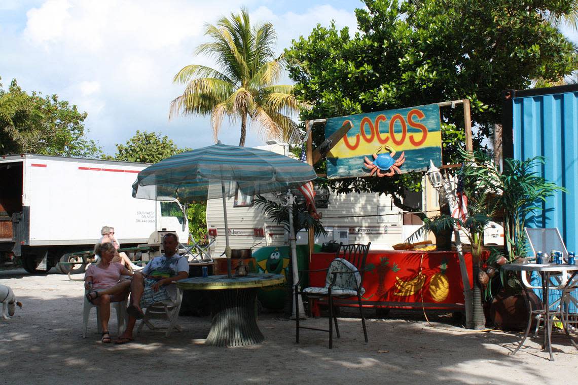
A tour of Miami's high ground
These six spots rank among the most colorful of Miami-Dade County's 28 highest points, stretching from Little Haiti to Palmetto Bay.
The reddest areas indicate elevations over 20 feet
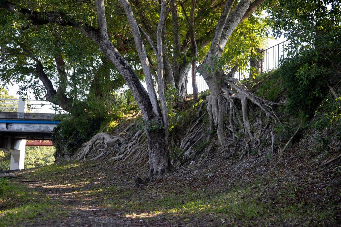
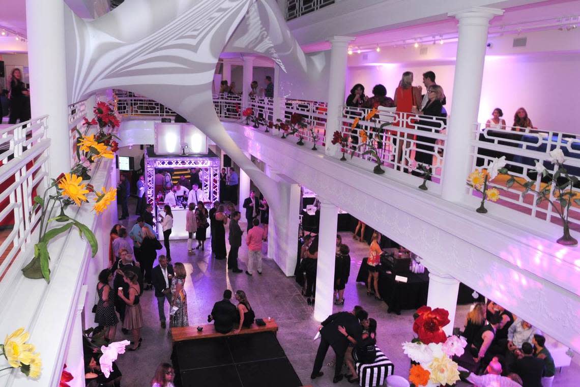
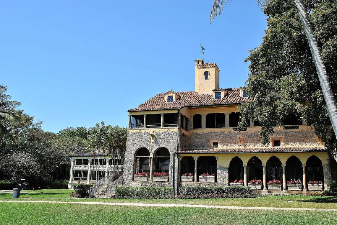
South Bayshore’s king of the hill
Location: 1628 Micanopy Ave. Elevation: 22 feet above sea level.
It’s hard to pin down the highest point in Miami, but one of the leading contenders — according to data from lidar drones that bounce lasers off the ground to measure elevation, as well as on-the-ground research by a group of hobbyist mountain climbers who travel the U.S. seeking the highest points in every county — is at the corner of Micanopy Avenue and Halissee Street in northeastern Coconut Grove.
Move over, Everest climbers. The rarest peaks to scale may be in Miami-Dade County
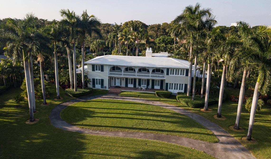
Up on a limestone bluff that slopes down to South Bayshore Drive in Coconut Grove sits the home of lawyer A.J. Barranco, who may rank as king of the hill in Miami-Dade, at least as far as home elevations go.
“I’ve always been told this is the highest point in Miami-Dade County,” Barranco said.
The bluff Barranco’s house stands on was one of the most prominent features of the early South Florida coastline; it was part of the first land grant in the history of U.S. control over the Miami area.
The New Orleans-style colonial house was built in 1940 for George Whitten, then the president of the iconic Miami-based fashion retailer Burdine’s. Whitten sold the house after living there for six years, he wrote in a 1978 letter to Barranco, because World War II had broken out and he couldn’t find any workmen to mow the palatial lawn. Plus, construction had started on the nearby Mercy Hospital, and Whitten and his wife were “afraid the ambulances would distract us at night.”
The house eventually passed to O.J. Tanner Jr., whose father founded Tanner’s, an early Miami grocery chain. During the Cuban missile crisis in 1962, Tanner blasted a bomb shelter deep into the bluff. The 20-by-20 foot shelter was locked behind a lead-lined door and stocked with a gas generator, air filters, a washing machine, two bathrooms and a kitchenette complete with a refrigerator, freezer, dishwasher and a complete set of Rosenthal china.
After Barranco bought the house in 1978, he ripped out most of the original appliances and turned the shelter into a wine cellar, which he says once held thousands of bottles of wine. “Right now I’m down to probably 500,” he said, with a collection that’s big on ports, chardonnays and burgundies.
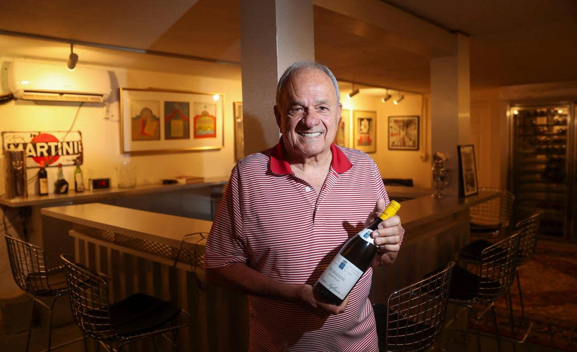
Barranco, who has hosted fundraisers and events for prominent figures like former U.S. President Jimmy Carter and ex-Florida Gov. Lawton Chiles, likes to invite guests down to the cellar for a drink before a dinner party. The only downside? When big storms roll in, he has to go downstairs and pick up all the rugs in the cellar because it can flood during heavy rains.
The grand cliffs of Coral Gables
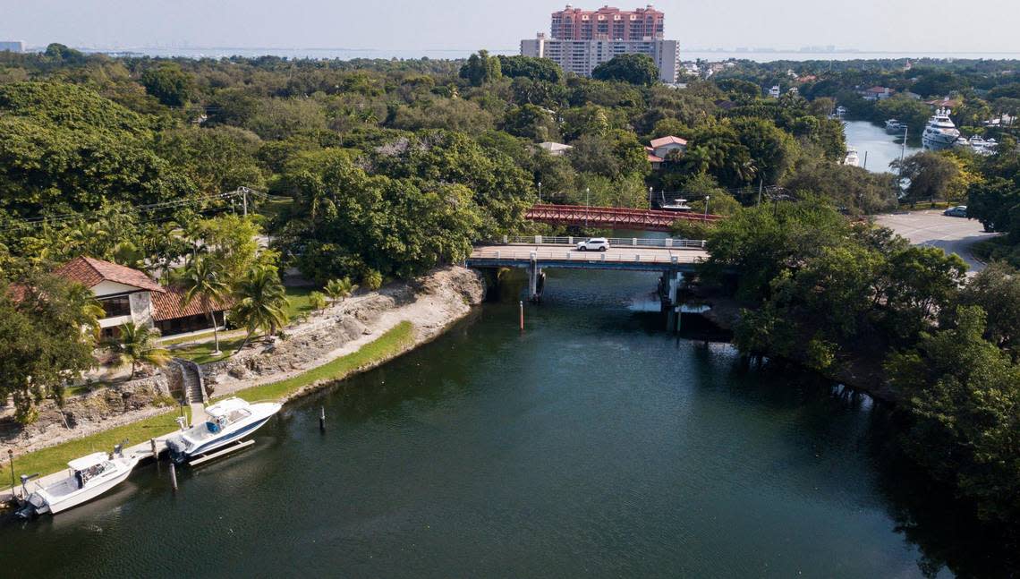
Location: Cocoplum Circle. Elevation: 20 feet above sea level.
A leafy traffic circle at the intersection of Old Cutler Road, Sunset Drive, and Lejeune Road marks the entrance to the gated enclave of Cocoplum. To the north and east of the circle runs the Coral Gables waterway, which is bordered on both sides by limestone cliffs that climb up to 20 feet above sea level. On a rocky outcropping by the water, fishermen like to gather to catch blue runner, mangrove snapper, grunt, barracuda and occasionally a blue crab.
On a December day, Luis Pujol cast his line into the canal while he waited to pick up his wife from work at a nearby house. Pujol, 32, has been coming to this spot to fish since he was 4. His father fished here, as did his grandfather, a commercial fisherman who came to Miami from Cuba in the 1970s. “I like to fish here because nobody bothers me,” Pujol said.
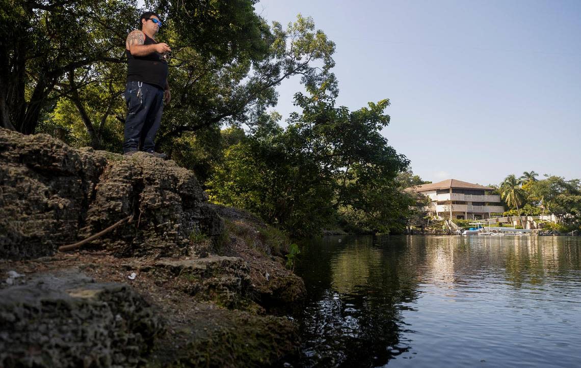
The secluded spot isn’t just a fishing haunt, Pujol claims: Smugglers bringing goods into Cuba have traditionally traded here. During the Mariel boatlift, the spot became a drop-off point for Cuban migrants who wanted to avoid the immigration officials waiting for them at official ports of entry. Enterprising captains — including, Pujol confesses, his own grandfather, who owned a 38-foot lobster boat — would pick up migrants in Cuba and deliver them to waiting family members parked at the traffic circle.
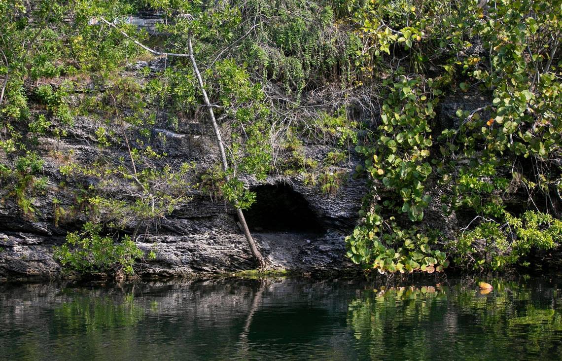
“A lot of Mariel came through here, from the stories I’ve heard,” Pujol said. One of those stories, passed down from his grandfather, involved a group of migrants hiding in a limestone cave along the side of the waterway while police searched the area for smugglers.
To this day, Pujol says, he sometimes sees families come to the side of the canal to leave offerings: “Jars with flowers in them. A doll. Messages that say, ‘I love you. I hope you’re doing okay.’ My family says people do that out of respect for family members who passed away on their way here.”
The estate of the pineapple king
Location: 4514 NE 1st Ave. Elevation: 19 feet above sea level.
Susana Baker, a former South Beach Realtor turned arts journalist, radio host and Miami art tour guide, lives on a hill in the neighborhood of Buena Vista.
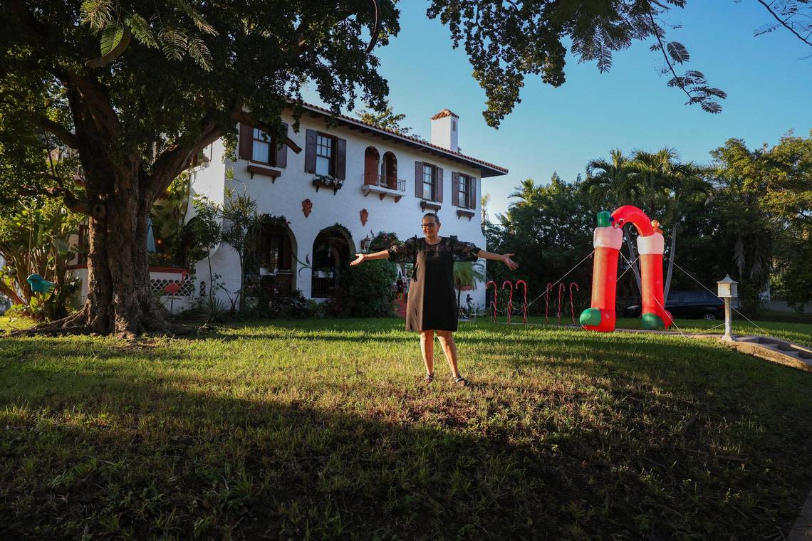
It was here, during the roaring 1920s, that South Florida’s “pineapple king” built his estate. Theodore Vivian Moore had arrived in Miami in 1902 and built a massive pineapple plantation that stretched from what is now the Design District up to parts of modern-day Miami Shores. In 1924, he cleared some of the highest ground on his land for a Mediterranean Revival-style mansion at the corner of what is now NE 1st Avenue and 45th Street.
He also built a nearby furniture showroom known as the Moore Building, which became the centerpiece of the Design District in the days when it was a Mecca for home furniture. The building has since been remodeled to fit the Design District’s contemporary, artsy identity, with an avant garde atrium designed by starchitect Zaha Hadid.
Moore’s descendants sold his house in 1942. It later served as a church and convent for the Universal House of Prayer and eventually sat vacant for a decade until Baker bought it in 1993. The moment she saw the house, perched on a hill, she fell in love with it. “It was just magic,” she recalls.
The house, however, was boarded up and in disrepair. Baker spent an hour pounding on the front door with a hammer before she managed to pry it open and walk inside for the first time. When she entered, she says, she saw a vision: “A tall lanky gentleman with tailcoats was walking down the stairs with a tray of champagne flutes.” Meanwhile, in the living room, she recalls a ghostly party full of long-dead guests from the 1920s era when the house was built.
Baker takes the spirits seriously, but she doesn’t mind their presence. The ‘20s house guests mingle with priests and nuns from the house’s church days and the souls of her mother and father, who each died inside.
“This is my home,” Baker said. “This is where I’m going to live, laugh, cry and die one day.”
Next year, when the house turns 100 years old and Baker turns 65, she plans to host a Great Gatsby-themed party to recreate the vision she had when she walked inside for the first time.
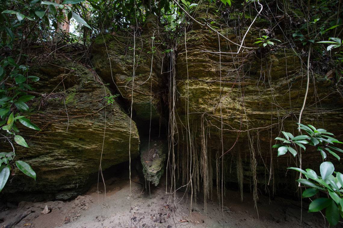
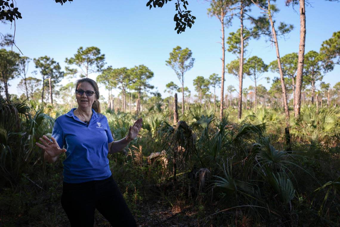
The cave of the woolly mammoth
Location: The Deering Estate. Elevation: 16 feet above sea level.
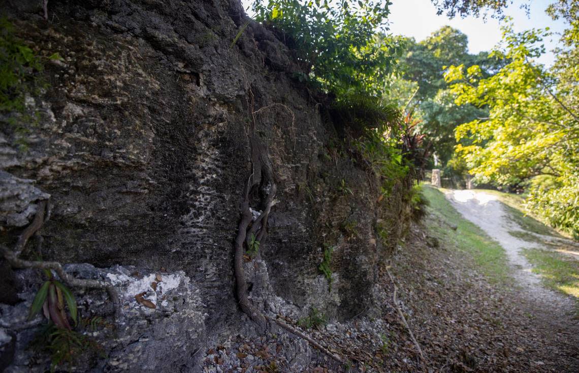
The ridge of limestone rock that runs through the Deering Estate offers a glimpse into Miami-Dade County’s distant past.
Scattered among a network of 17 caves and countless solution holes that have been weathered into the rock, researchers have found 200,000 bone fragments from long-extinct animals that lived as long as 40,000 years ago: mammoths, mastodons, saber-tooth tigers, American lions, dire wolves, giant sloths and more.
The rock also holds evidence of human habitation dating back 10,000 years. “People have always sought higher ground to build their homes on,” said Jennifer Tisthammer, head of conservation for Miami-Dade County Parks, Recreation and Open Spaces and the chief executive of the Deering Estate.
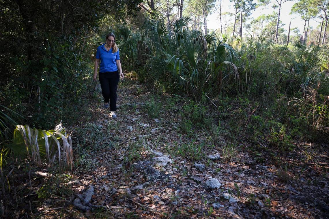
The highest ground on the estate, which rises 16 feet above sea level according to lidar data, holds the remains of Paleo-Indian settlements, Tequesta shell tools, Seminole hunting grounds, houses built by American and Bahamian homesteaders, and the short-lived town of Cutler, which briefly prospered until the Florida East Coast Railway bypassed it in favor of Perrine in 1903.
As the town declined, Chicago industrialist Charles Deering bought up the land and absorbed it into his estate, where he lived in a limestone house he built in 1922. During Prohibition, Deering built a wine cellar under the house hidden behind fake cabinetry.
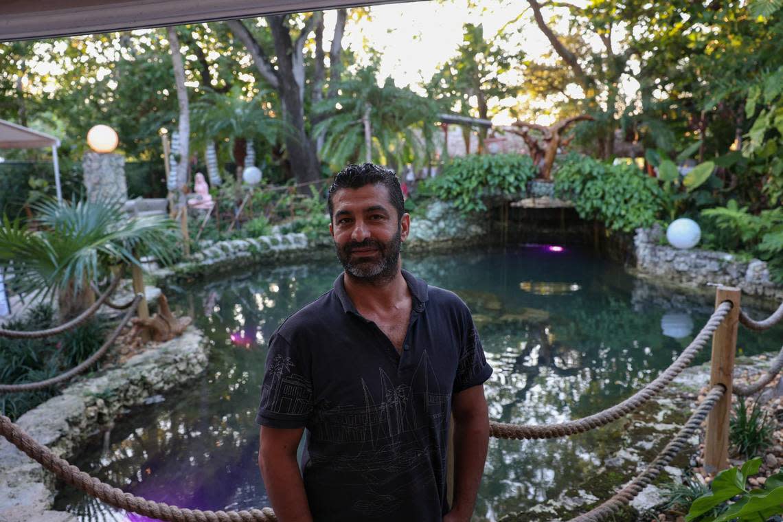
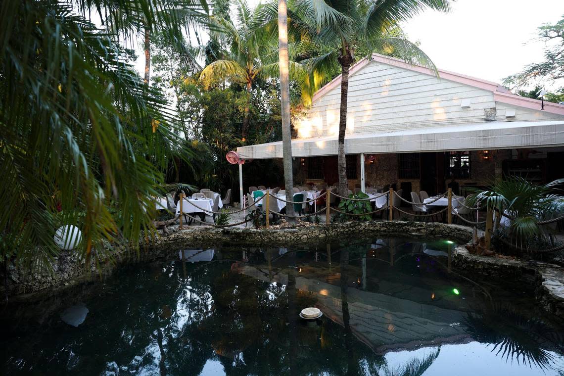
Dine at a pump house with a strange past
Location: 5808 NE 4th Ct. Elevation: 18 feet above sea level.
ZOI, a Mediterranean restaurant in Little Haiti, operates out of a limestone rock house that has stood on a slight rise just west of Biscayne Boulevard for nearly a century. ZOI opened its doors in November. It’s the 12th restaurant from Turkish restaurateur Ahmet Demir, who fell in love with the historic site and the limestone fountain built into its backyard: “As soon as I saw the garden, I said, ‘That’s it. No matter what, we’re taking this.’”
The limestone building that houses ZOI was once a pump house for a short-lived subdivision called Bay Shore, which mainly covered the neighborhood that is now Morningside. James Nunnally, a Delaware candy company executive turned South Florida real estate developer, began laying out the streets of Bay Shore in 1922. To provide drinking water for his residents, Nunnally drilled wells into the ridge at the highest point in the subdivision and built a pump house out of limestone rock and hardy Dade County slash pine in the Mediterranean revival style.
After the city of Miami annexed Bay Shore in 1925 and hooked the neighborhood up to its own drinking water system — and after the devastation of the 1926 Hurricane plunged South Florida into an economic depression — the pump house was abandoned. In 1935, it was turned into a private home, and it alternated between periods of occupancy and abandonment for the next several decades.
In the 1970s, it fell into the hands of Robert Bowman, a Miami businessman who was later convicted and sentenced to life in prison for the 1967 murder of a 14-year-old girl in Toledo, Ohio. Bowman turned the house into a meeting place for a transcendental spiritual group called the Cornucopia Centers to “explore concepts such as multisense awakening and cosmic rites,” according to a Miami New Times series about the house, which raises the possibility that the bodies of other Bowman victims might still be buried on the property.
By 1995, the dilapidated house was condemned and slated for demolition. But local preservationists intervened to save the historic building and find a private buyer willing to restore it. The house became a beauty salon, and later a Mediterranean restaurant called Café Roval, which folded during the pandemic. Demir bought the property in May and opened ZOI.

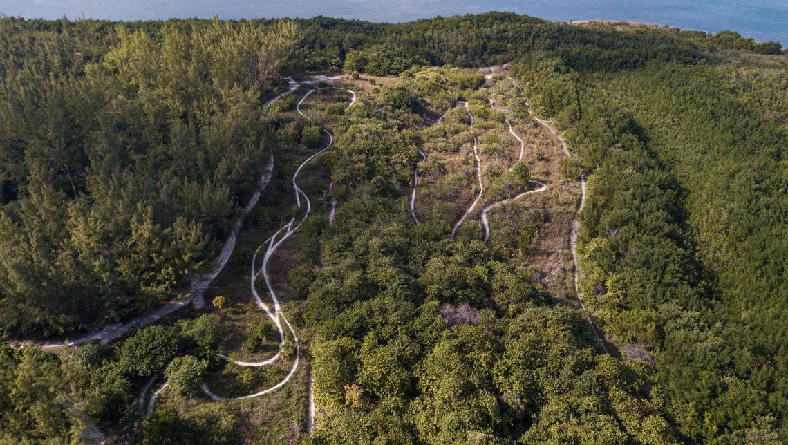
Pedal to the tallest peak of all
Location: 3801 Rickenbacker Causeway. Elevation: 50 feet above sea level.
The 50-foot-tall dune at the north end of Virginia Key doesn’t really count as a natural high point. It’s man-made, a dumping ground for sand dug up during Port Miami dredging projects dating back to the 1970s. But it is the single highest ground you can stand on in Miami-Dade County without hiking up a landfill (as our columnist Dave Barry did in 2010).
A volunteer team of mountain bikers has taken advantage of the slope to lay out a series of bike trails that range from flat bunny hills for beginners to advanced courses with jumps and hard drops down wooden stairs.
“I come out here and I don’t feel like I’m in Miami,” said Christian Perez, a 40-year-old firefighter who has been biking the trails here for the past eight years. “I just kind of disconnect.”
Until last year, the site that used to host a ramshackle fish shop/beer store/feral cat colony known as Jimbo’s had become the Virginia Key Outdoor Club (VKOC), where nature lovers could rent kayaks, mountain bikes, and other gear. But in August, VKOC met the same fate as Jimbo’s: The city of Miami shut it down. The bike trails, however, remain open.
This climate report is funded by Florida International University, the Knight Foundation and the David and Christina Martin Family Foundation in partnership with Journalism Funding Partner. The Miami Herald retains editorial control of all content.