Check out a rushing river, scenic pond and a Troll Cave at Spencer Property in Foster
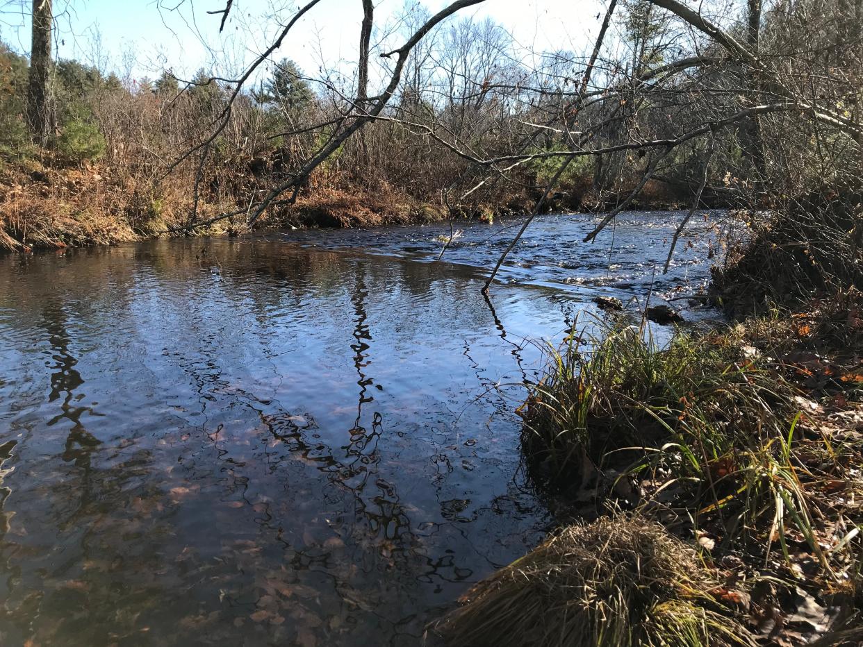
FOSTER – The Ponaganset River rushes swiftly over a shallow, rocky riverbed as it winds southeast along the border of the Spencer Property, a public sanctuary managed by the Foster Land Trust.
To reach the river, I walked across the 147-acre preserve by circling a man-made pond, passing cellar holes and stone walls from an old farm and climbing a glacial moraine with huge boulders that hide underground cavities that locals call the Troll Cave.
The different terrains make for an interesting hike on property donated to the land trust in 1999 by the family of the late Dr. Robert F. Spencer Jr., a popular local general practitioner who was known for making house calls and seeing patients without an appointment in his brick office on Route 6.
From a small lot off Old Danielson Pike at the southern end of the preserve, our son, Daniel, and I set out on a yellow-blazed trail, called the Ponaganset River Trail.
Passing a barred gate, we walked through a thick forest on a wide, well-traveled gravel road that Spencer had cut after he bought the property in the late 1960s. The road has been regraded to make it wheelchair-accessible. To the left, an opening in the trees offered a view of a large, mowed field that ran uphill to a farmhouse. To the right, wetlands spread into the woods.
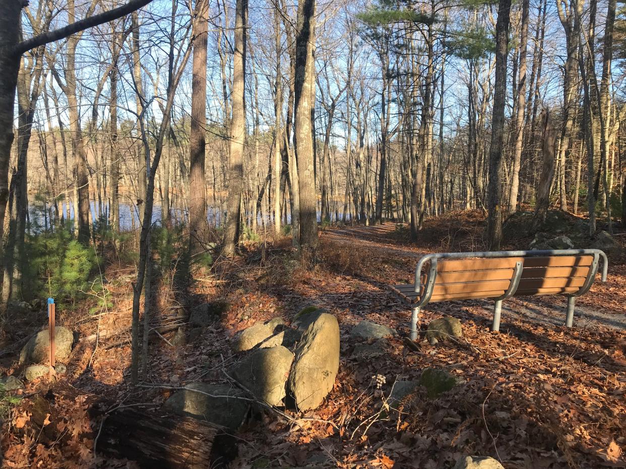
A short distance later, we came to a bench overlooking small, circular Spencer Pond, which was formed in a natural depression in the land.
An underground stream, and Pot Luck Rock
At the bench, we took the blue-blazed trail on the left and started to follow it clockwise around the pond. The rocky and rooted path runs across a hillside above the pond and crosses several rivulets and streams that required some rock hopping. One stream ran underground, and as I passed over it, I heard the deep-toned “glug-glug-glug” of the water tumbling over subsurface rocks.
The trail then rose to what some maps label as Pot Luck Rock, a flat slab of granite perched on several stones to form a flat surface. I’ve seen similar structures on other hikes, such as Table Rock in the George Parker Wildlife Refuge in Coventry. Not sure who built this one, or why.
I followed the shoreline north on the path that, at times, ran through thick brambles and over wetlands and moss-covered stones. The path reached the edge of a grassy 150-yard-long earthen dam built to hold back the water in the man-made reservoir.
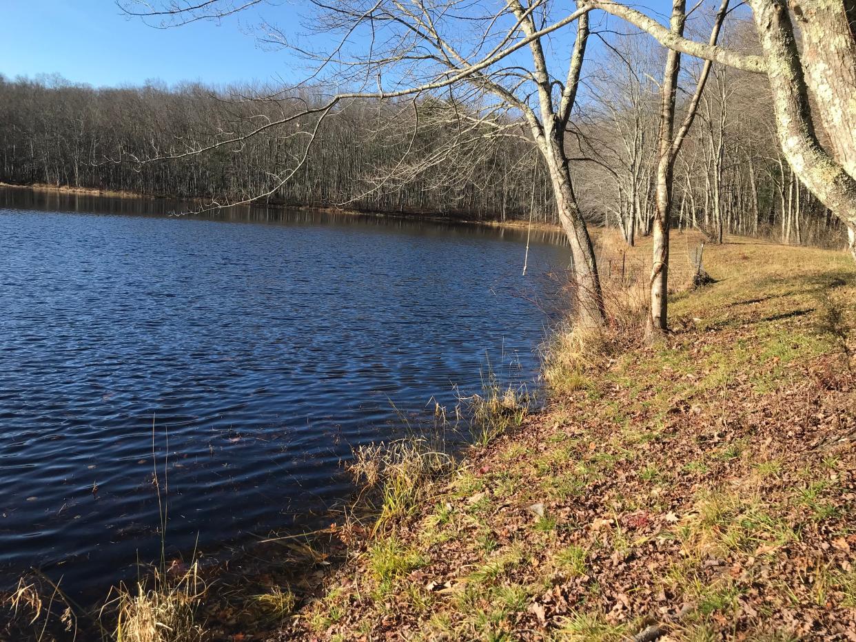
Linda Spencer, a daughter of Dr. Robert Spencer, said the area was once swampland, and her father built the dam to create the pond. He, his wife, Marjorie, and their five children didn’t live on the land, but they all hiked there and he often fished in the pond. Anglers still wet a line there and report catching trout and bass.
Beaver activity sometimes results in a flooded trail
Walking along the top of the 20-foot-wide dike, I found a fenced drain that funneled water under the dam to a stream that ran toward the Ponaganset River. Beavers often block the drain, which backs up the pond and floods the nearby trail. Volunteers have tried to prevent the flooding by trapping and relocating the beavers nearer the river and removing the sticks and mud from the drain.
Just after the fencing, we noted a rope swing hanging over the edge of the pond from a branch of an oak tree.
At the end of the dam, we picked up the yellow-blazed trail again, passed another sitting bench near the outlet from the pond, and had to watch our steps across ruts in the road filled with water and some small seasonal streams.
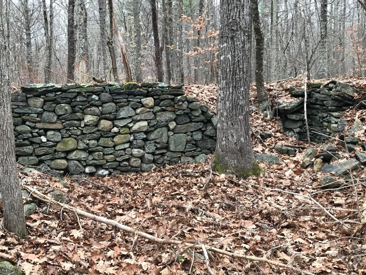
The orange-blazed Boulder Field Trail opened on the left, but I saved that for later. Rather, I took an unmarked path on the right that some maps call the Gravel Pit Trail. The short road ran downhill before reaching a low area and doubling back in a loop. Town workers once dug gravel there for local projects. Several side paths ran west and off the property, so I returned to the yellow-blazed trail and soon passed a large cellar hole and lines of stone walls on the left. The land was probably farmed in the 1800s, and the walls may have been pens for cattle and sheep.
The path narrowed and I saw a sign tacked on trees for “Path to Health,” an exercise program run by the American Heart Association and R.I. Prevention Coalition in the early 2000s.
The winding path of the Ponaganset River
I crossed several rivulets and made my way through thick shrubs and over several downed and uprooted trees. The footpath reached the Ponaganset River, which was fast-running, crystal clear and about 20 feet wide.
The Ponaganset River flows naturally from the Ponaganset Reservoir in Glocester and runs southeast for 12.5 miles through Glocester, Foster and Scituate to the Scituate Reservoir. Along the way, it is fed by several unnamed tributaries and several other sizable brooks, including the Shippee, Winsor and Dolly Cole.
The river also flows over three dams and under about a dozen roads, including Hartford Avenue and Danielson Pike in Foster and Plainfield Pike in Scituate.
The river is considered a pristine cold water stream that is valued for fishing and part of a 534-acre watershed that feeds drinking water supplies and provides habitat for wildlife and birds. The Foster Land Trust, Audubon Society of Rhode Island and the Rhode Island Department of Environmental Management have worked together to protect the corridor.
I could see on the opposite side a cleared field and a stack of cut brush and trees. The trees on the private property were blown down and damaged during a severe storm several years ago, said Linda Los Tibbetts, chair of the Foster Land Trust.
She also told me there are plans to someday try to connect the Spencer Property to the Hayfield Property, also owned by the land trust, to extend the hiking trail. But that may require a bridge to cross the river.
I retraced my steps on the yellow-blazed trail until I reached the red-blazed Cardinal Trail on the right. The trail, cut by Boy Scouts, headed east, and I noted a yellow diamond indicating that the land was DEM-owned and part of the 68-acre Carpenter property, named for the family that sold the land to the state. Just north of the Carpenter property is a 31-acre tract called the Franklin property that is also owned by the state.
On prior hikes, I’ve taken the Cardinal Trail uphill to a fork, and at an intersection, found a complex of stone walls and a three-sided, 6-foot stone foundation that may have been for a barn.
The trail continues to East Killingly Road, where there’s a neat, stone wall-lined cemetery and members of the Simmons and O’Dette families are buried. I returned to the red-blazed trail and followed it west back to the yellow-blazed trail.
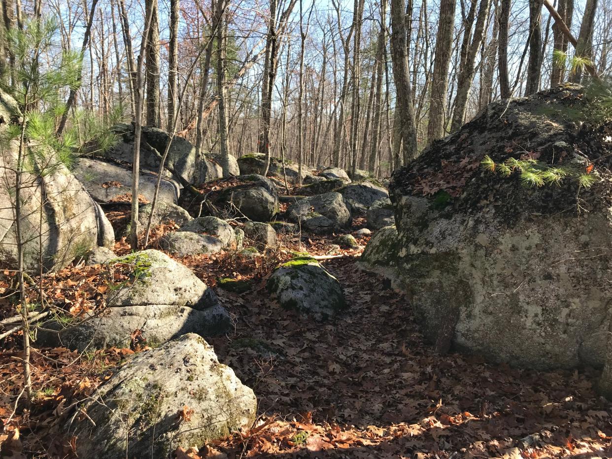
After walking south for a short distance, Daniel and I turned right on the orange-blazed Boulder Field Trail. The terrain changed quickly from flat to rocky, with huge boulders, and we realized we were climbing along a glacial moraine, deposited by receding glaciers during the Ice Age.
At a junction, the trail split. We went right but the path soon stopped with an orange “END” sign painted on a tree near the backyards of houses. I heard dogs barking. So we turned and took the orange-blazed trail southeast through one of the more interesting sections of the preserve. Huge boulders covered with leafy, foliose lichen, – which requires clean air in an old growth forest – lined the rocky path that was covered with about 4 inches of leaves, making walking a bit tricky.
A peek inside the Troll Cave
In one area, I explored a field of boulders, some of which were stacked side by side or on top of each other to create deep crevices and underground cavities. One formation is called the Troll Cave. I looked inside, but found no animals or fantasy creatures in the dark holes.
We continued downhill and southwest on the orange-blazed trail until reaching the blue-blazed path we had followed earlier. We took a right, walked back to the bench above the pond and returned on the yellow-blazed road to the trailhead.
I followed the yellow-blazed trail back to where I'd started. In all, I walked about 3.5 miles over two hours.
The Spencer Property has a lot to offer, including different types of terrain, some farming history and a good look at the Ponaganset River. I thought about how the river would change in the spring after the winter melt and runoff and made a note to come back.
Lectures and signings for “Walking Rhode Island” book
John Kostrzewa’s new book, “Walking Rhode Island: 40 Hikes for Nature and History Lovers with Pictures, GPS Coordinates and Trail Maps,” is available at local booksellers and at Amazon.com. He’ll sell and sign books after these presentations and slideshows about his hikes:
Saturday, March 9: 2024 Rhode Island Land & Water Conservation Summit at the University of Rhode Island. Registration required at rilandtrusts.org/summit.
Monday, March 11: Cumberland Public Library at The Monastery. 6:30 p.m.
Monday, March 18: Weaver Library in East Providence. 6:30 p.m.
If you go ...
Parking: Available for a few cars.
Dogs: Allowed, but must be leashed.
Difficulty: Easy to moderate.
GPS Location: 41.83057, -71.71502
The Walking Rhode Island column runs every other week in the Providence Sunday Journal.John Kostrzewa, a former assistant managing editor/business at The Providence Journal, welcomes email at johnekostrewa@gmail.com.
This article originally appeared on The Providence Journal: Hike along Ponaganset River and a pond at Spencer Property in Foster
