Bear Creek expected to rise again. What the city of Merced says in a new warning
The waterway that runs through the middle of Merced, Bear Creek, wass expected to rise to the flood monitoring stage, according to Jennifer Flachman, the public information officer for the city of Merced.
Officials say, though, that water is not expected to exit the sides of the creek or cause the kind of flooding seen in the region in early January. An atmospheric river in January caused flooding in Merced and led to evacuations and significant damage in Planada.
Up to a half-inch of rain was expected late Tuesday in Merced and much of the San Joaquin Valley, including Fresno, according to the weather service.
Bear Creek will be full of swift-moving water, Flachman said in a news release. So residents are urged to stay clear of the waterway and off of the bike paths and trails that will be partially submerged.
“Localized flooding can be expected on city streets, and potholes may be made worse with the increased rain,” she said. “The Public Works Department will be working to address issues as they arise.”
Red Cross sets up mountain shelters
The Red Cross set up shelters as widespread power outages continued in Central California mountain communities
Thousands of users in Mariposa, Madera and Fresno counties where mountaintops were pummeled with snow continued Tuesday to experience power outages, according to Pacific Gas and Electric.
Outages began Friday as the region was blanketed in snowfall, with more coming.
Mariposa and Oakhurst were likely to get at least 6 inches of snow late Tuesday, and 12 inches or more was predicted in higher elevations, according to the National Weather Service in Hanford.
The Red Cross added three evacuation shelters for the Central Valley.
Fresno County: Reedley College Gymnasium, 995 N. Reed Ave., in Reedley. It operates 24/7.
Madera County: Oakhurst Community Center, 39800 Fresno Flats Road, in Oakhurst. It’s open 9 a.m. to 6 p.m.
Mariposa County: Mariposa Senior Center, 5246 Spriggs Lane, in Mariposa. It’s open 9 a.m. to 6 p.m.
“Stay safe on the roads and use extra precautions traveling,” the Red Cross said on Facebook. “Everyone is welcome and all disaster assistance is free.”
Residents who go to the shelters should bring only their essentials, like medication, clothes and toiletries, officials said. Pets that can be kenneled are allowed.
The shelters are ADA-compliant and have restrooms and showers, officials say. The Red Cross provides cots, blankets, pillows and meals.
Here are snow amount probabilities for today through tomorrow. High snow totals in the Sierra and low elevation snow combined with high winds will create near impossible travel. Bigger highways such as HWY 58 and I-5 will likely see closures at one point in mountain passes. pic.twitter.com/gpemJujYXz
— NWS Hanford (@NWSHanford) February 28, 2023
Highway conditions
Here’s the status of major roadways affecting Central California travelers as of 8:30 a.m. Tuesday.
Highway 59: A nearly 10-mile stretch south of Merced between Reilly and Sandy Mush roads is closed because of flooding, the California Highway Patrol said. There was no estimated reopening date.
Highway 41: The highway remains closed at the southern entrance to Yosemite National Park.
Highway 58: Tehachapi Pass east of Bakersfield is open.
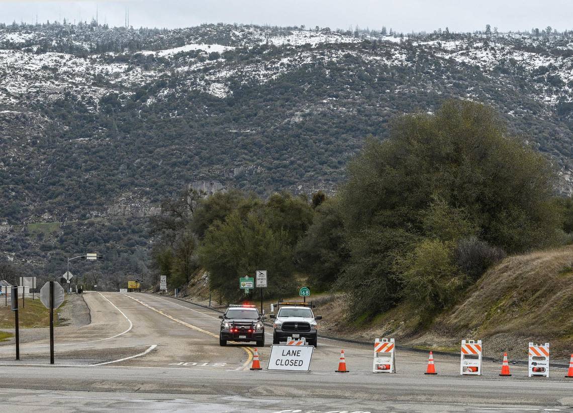
Highway 168: The eastern Fresno County highway to Shaver Lake remains closed just past Prather at Lodge Road, at the bottom of the four-lane.
Highway 180: The highway to Sequoia National Park is open, though park officials warn it could close anytime due to weather conditions.
Interstate 5: The Grapevine is open, though a High Wind Advisory has been issued.