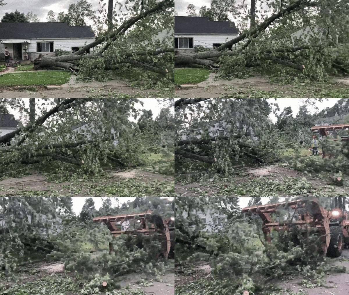
650,000 in the dark after severe storms leave trail of damage across Midwest
Summer is in full swing across the Midwest and Northeast, and a recent surge in heat and humidity helped to fuel a bout of severe thunderstorms that left hundreds of thousands in the dark on Wednesday.
Wind-whipped rain pelted parts of Michigan, Indiana, Ohio and Kentucky on Wednesday afternoon as a cold front collided with warm, steamy air. This sparked a line of severe thunderstorms that swept across the region.

Powerful storms caused widespread tree damage and power outages in Bronson, Mich. on June 10, 2020. (AccuWeather / Blake Naftel)
Thunderstorms began to rumble over central Indiana and western Michigan before the clock struck noon on Wednesday with the storms eventually congealing into a line of severe thunderstorms stretching more than 300 miles long.
The primary threat was frequent lightning and damaging winds with some locations clocking gusts over 70 mph. A few communities also were dinged by hail with a majority of the hailstones measuring smaller than golf balls.

More than 650,000 were left without power across Michigan, Indiana, Ohio and Kentucky during Wednesday evening due to widespread damage to trees and power lines. Michigan experienced some of the worst of the storms with the state accounting for more than half of the region’s power outages, according to PowerOutage.us.
Related: Storms south midwest
A drone captures a shelf cloud approaching Bluffton, Indiana, on Wednesday afternoon. (Twitter/ @jtinneywx)
The severe weather was not just limited to the Midwest on Wednesday afternoon. A few strong storms popped up over the mid-Atlantic, including one that tracked directly over State College, Pennsylvania.
CLICK HERE FOR THE FREE ACCUWEATHER APP
Leading up to the thunderstorms, NOAA’s Storm Prediction Center (SPC) issued a moderate risk for thunderstorms that included portions of Michigan, Indiana and Ohio. This was the first time that a moderate risk had been issued for Detroit since June 12, 2013, according to AccuWeather Senior Weather Editor and Meteorologist Jesse Ferrell.
"Moderate risks are more typically issued for the Plains states during the peak of severe weather season in the spring," said AccuWeather Meteorologist Renee Duff. "To have one issued this far north and east showed the volatility of the atmospheric setup for Wednesday's severe weather."
RELATED:
Excessive rainfall to instigate flood concerns for East CoastDaily coronavirus briefing: New poll reveals Americans’ latest stance on pandemicMay's warm temperatures globally place the month in a unique spot historically
Strong thunderstorms will shift eastward heading on Thursday, but the storms are not expected to have as much gusto as they did on Wednesday. While there still could be some locally damaging storms along the East Coast, the primary threat will be flash flooding. Meanwhile, much cooler, drier weather will filter into the areas affected by Wednesday's storms as cleanup efforts get underway.
"In the zone from near Philadelphia to Jacksonville, Florida, a general 1-3 inches of rain is likely with an AccuWeather Local StormMax™ of 5 inches during the 12-hours period," AccuWeather Meteorologist Courtney Travis said.
Some of this rain could linger over North Carolina, South Carolina, Georgia and Florida through the balance of the week, extending the risk of flooding.
Keep checking back on AccuWeather.com and stay tuned to the AccuWeather Network on DirecTV, Frontier and Verizon Fios.
