Ancient walls — that served as ‘Google Maps’ for the Mayans — discovered in Mexico
The Mayans set themselves apart as masters of engineering, accomplishing constructive feats once thought to be impossible for their time.
They thought of everything — how the shadow of the stairs of their pyramids would look in the afternoon sun, how the moon would fit in the perfect window atop their sacred constructions.
Now, researchers believe they may have also developed a way to give each other directions across the forested Yucatán.
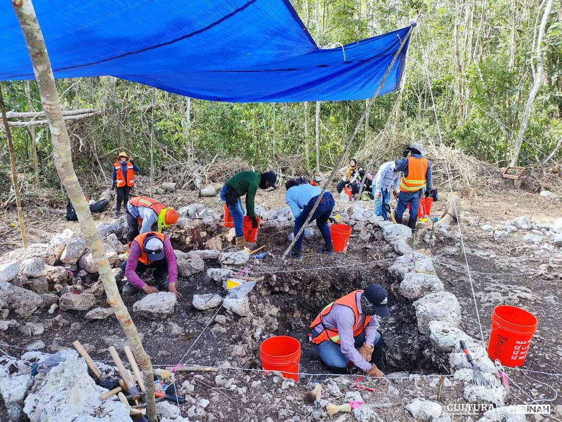
As part of an ongoing archaeological project in Quintana Roo, Mexico, researchers have discovered 83 albarradas, according to an April 24 news release from the National Institute of Anthropology and History, or Instituto Nacional de Antropología e Historia.
Albarradas are walls built from limestone that were common in pre-Hispanic constructions, and were relatively simple, the researchers said, making it easy to use in rural architecture.
Uncover more archaeological finds
What are we learning about the past? Here are three of our most eye-catching archaeology stories from the past week.
→ Farmer loses plow part in Polish field — then finds historic artifact during search
→Divers remove ancient Roman cargo from shipwreck — and find unique carvings. See them
→ Metal detectorists find ancient portrait in Danish field. See the 'legend' it depicts
In other archaeological finds, albarradas were used to outline crop areas or designate living spaces, according to the release.
But the researchers in Quintana Roo think these walls had a different function.
The walls have a novel design, the researchers said, often with “L” shaped sections or places where someone could sit.
They are also close to bodies of water, as the region is a peninsula extending into the Caribbean Sea, not in agricultural areas, according to the release.
For these reasons, the researchers believe that the walls were instead a way to help the inhabitants of the region get around, essentially an ancient Mayan “Google Maps,” they said.
The walls date to the Classic Mayan period, between 300 and 600 A.D., making them roughly 1,400 years older than Google’s online direction service.
Some of the walls were found close to foundations and by marks found on the ground, according to the release, meaning there may have been signage to help travelers navigate the stone labyrinth through the landscape.
The researchers noted that archaeological material, like things left behind from homesteads, were not found near the walls, meaning they were likely not part of a larger construction.
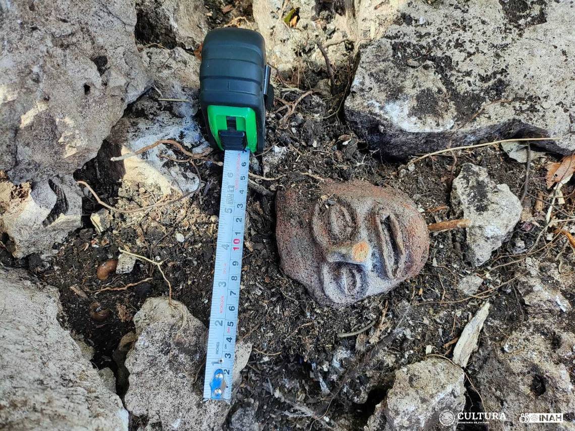
The archaeology project, which began in January 2023, has recovered 218 bags worth of ceramic pieces, three of metates (a stone used to grind grain or cocoa), two flint knives and many other artifacts that help to uncover Mayan history, according to the release.
Quintana Roo is on the eastern coast of the Yucatán Peninsula in southeastern Mexico.
Google Translate was used to translate the news release from the Instituto Nacional de Antropología e Historia.
Hidden ancient phallus carving discovered at Roman fort in United Kingdom — again
Metal detectorist stumbles on centuries-old artifact — once banned by tsar — in Poland
Metal detectorist stumbles on 250-year-old artifact linked to a pope, photos show
Underground builders find pottery pieces in Poland — and discover 600-year-old garbage
